Learn more
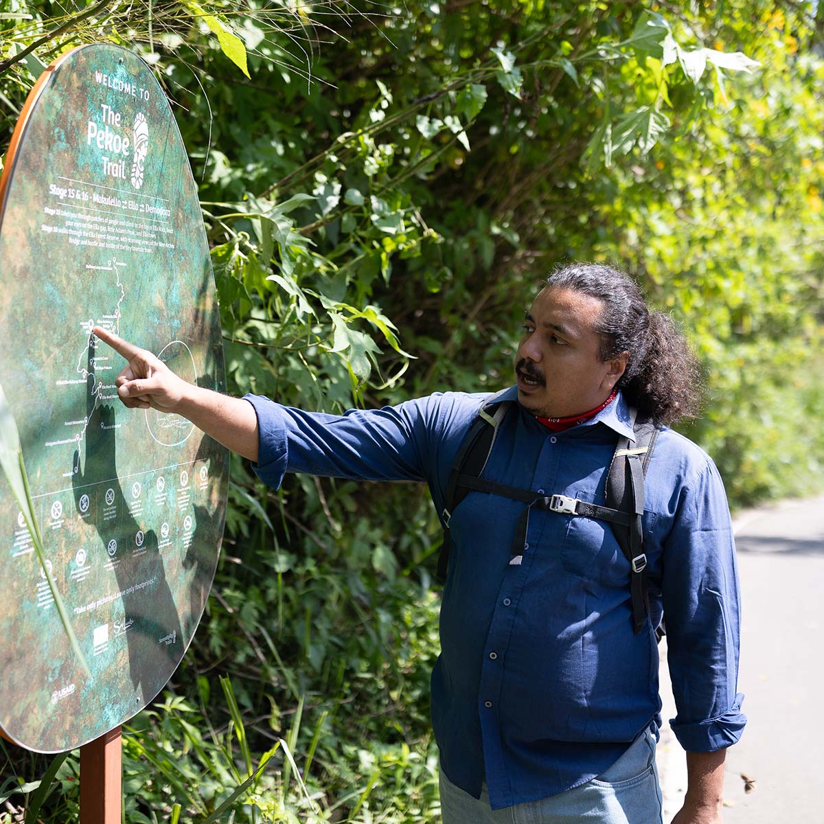
The Pekoe Trail
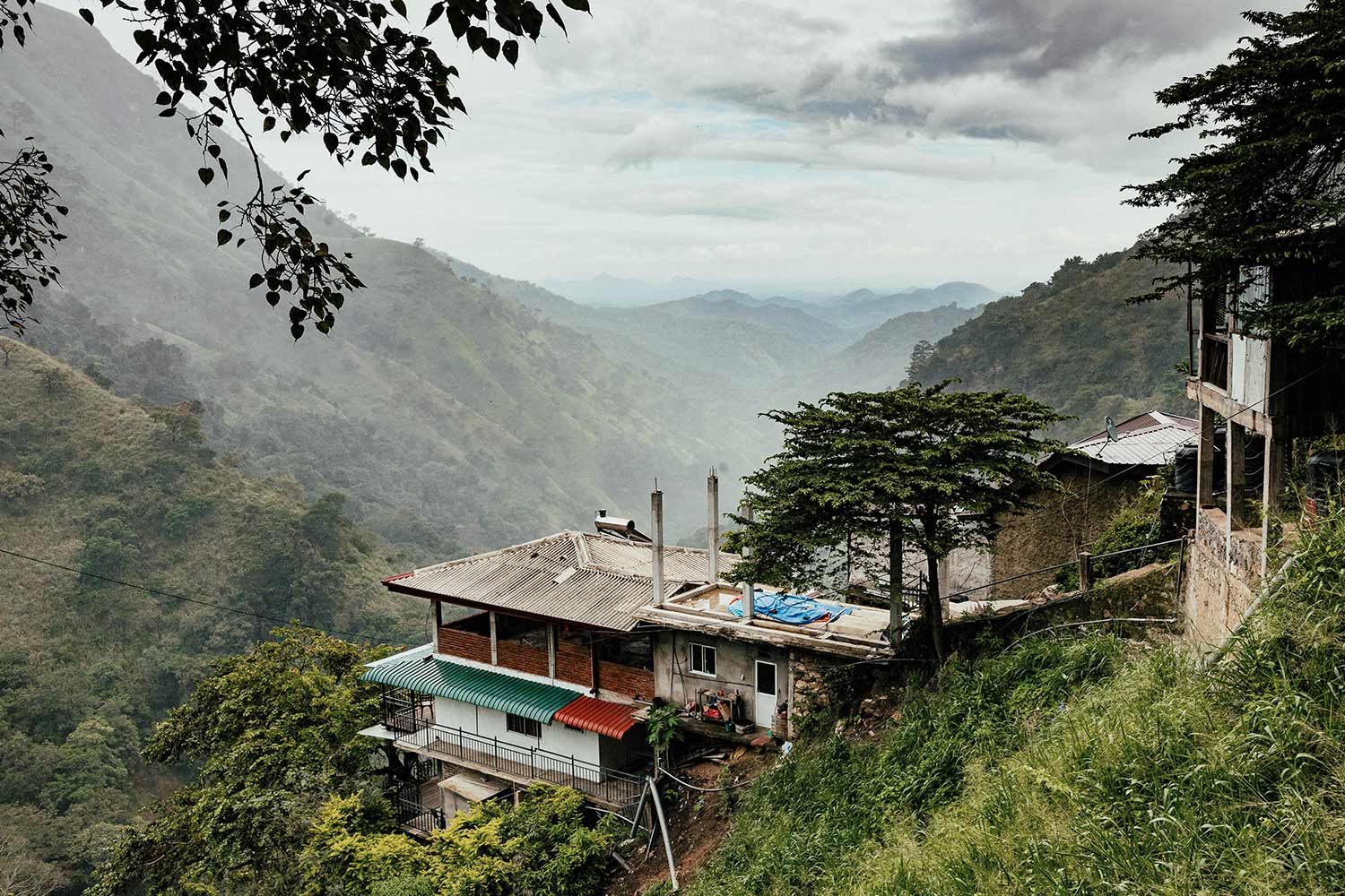
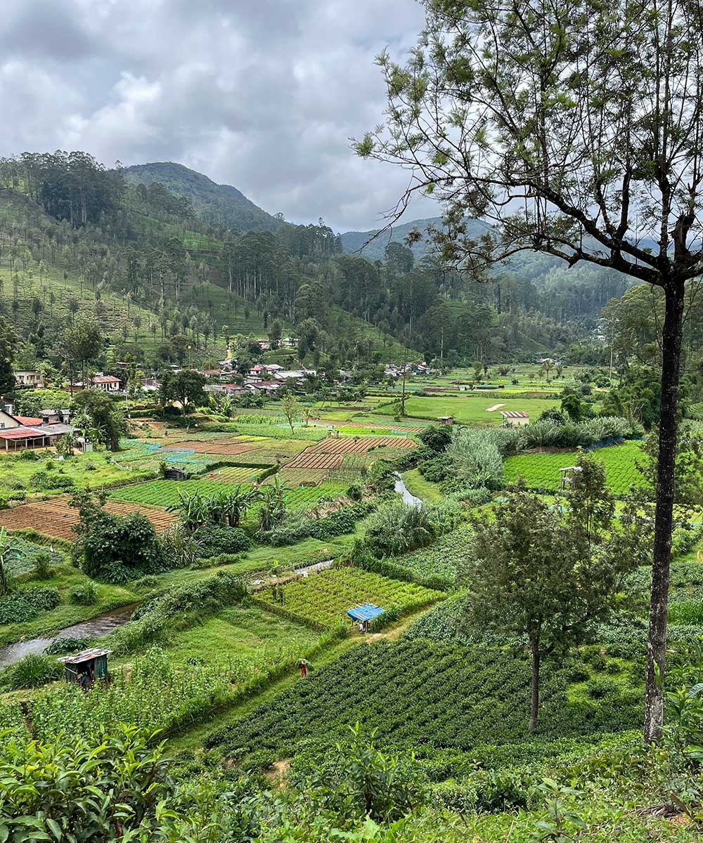
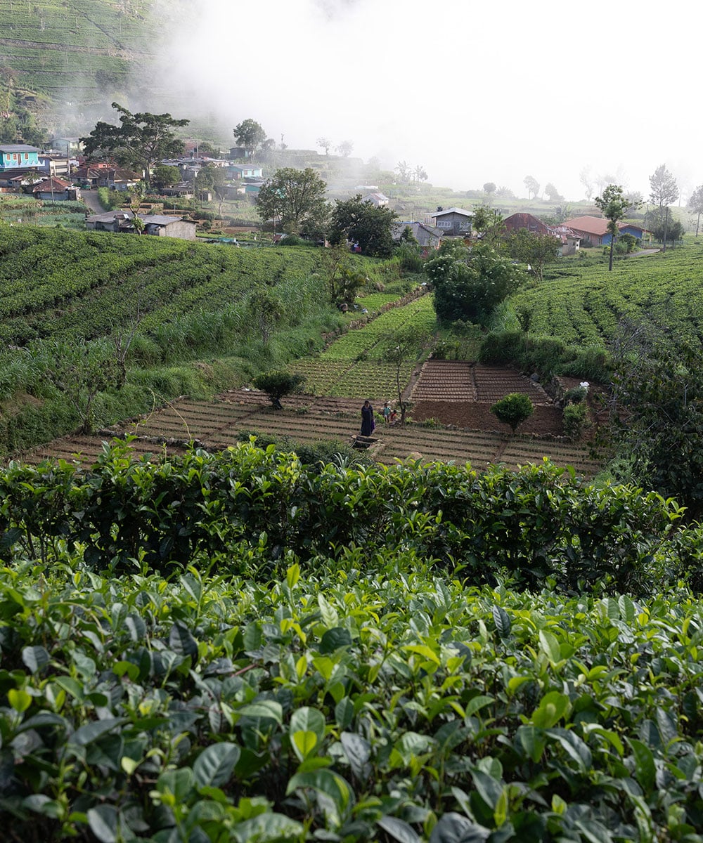
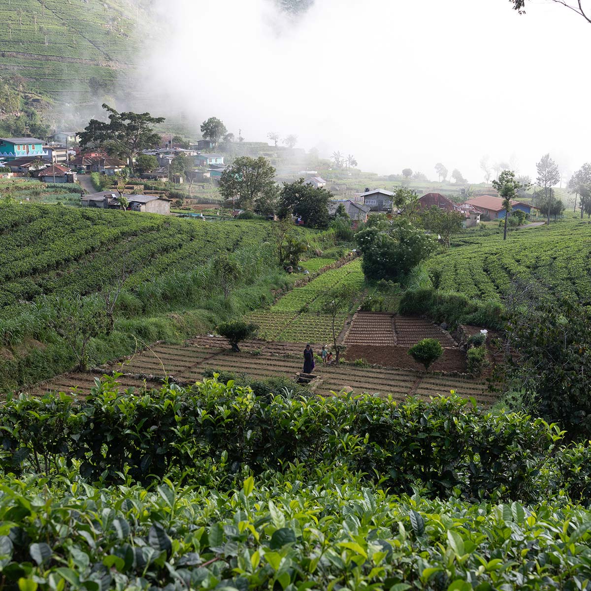
Launched in 2023, this pioneering long-distance walking trail, weaves together historic footpaths and old cart roads once used to transport Ceylon's prized tea, offering an immersive experience through misty peaks, emerald-green tea estates, and time-honoured villages.
Named for the high-grade black tea that has shaped this region for over a century, the trail stretches from the cultural capital of Kandy to the enchanting hill station of Nuwara Eliya, passing through iconic destinations like Ella and Haputale.
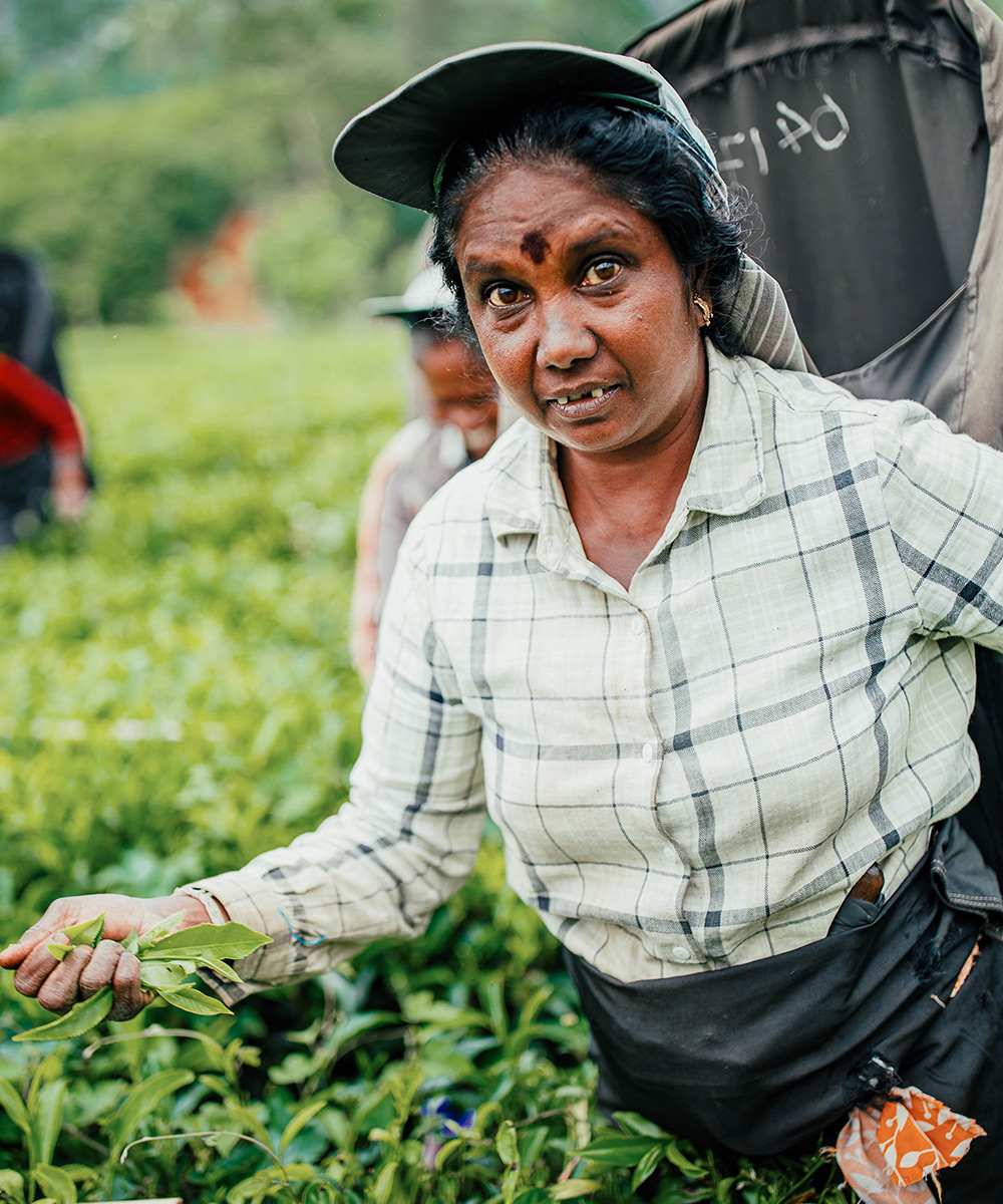
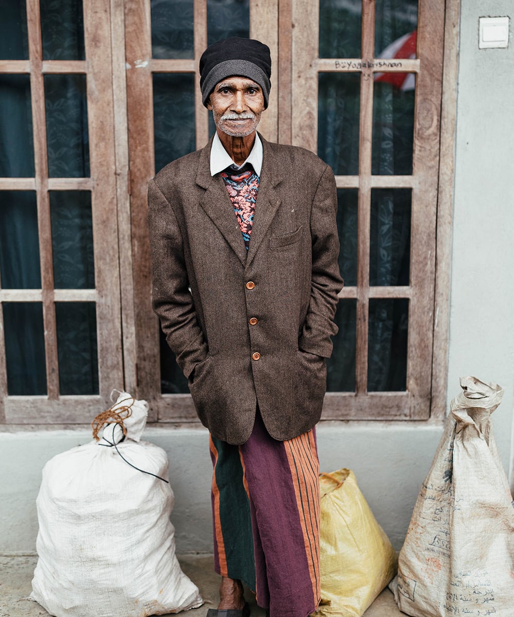
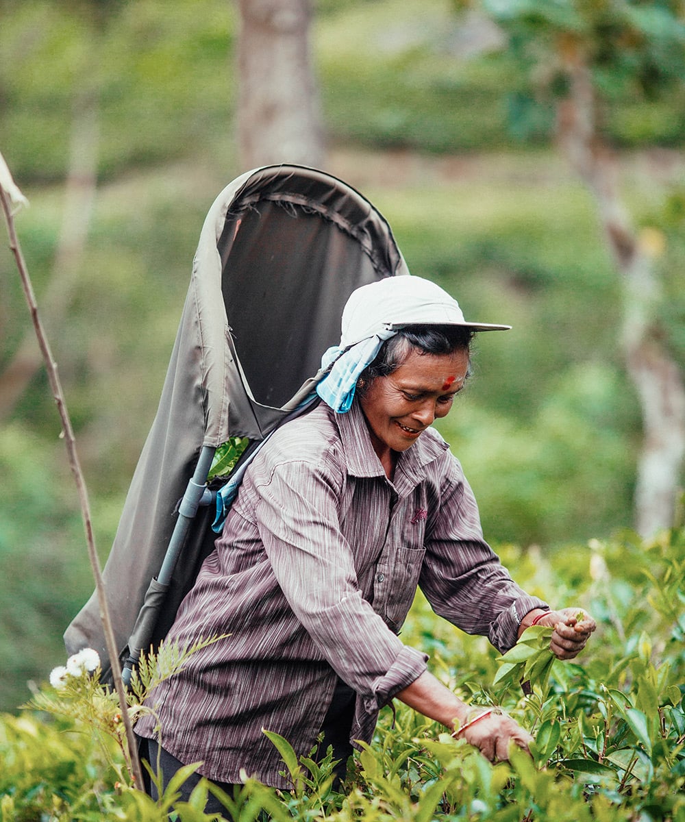
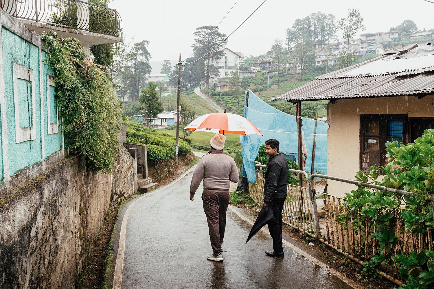
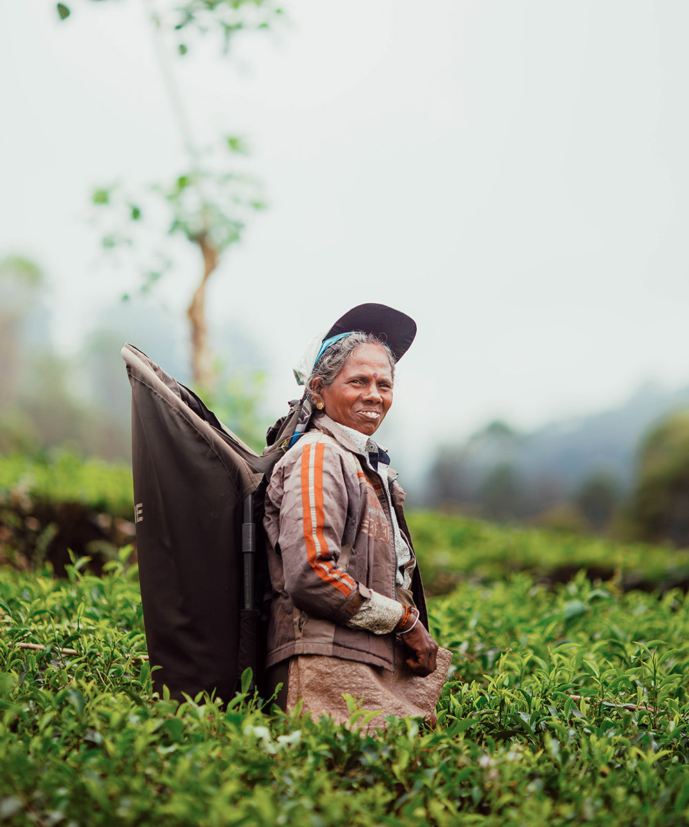
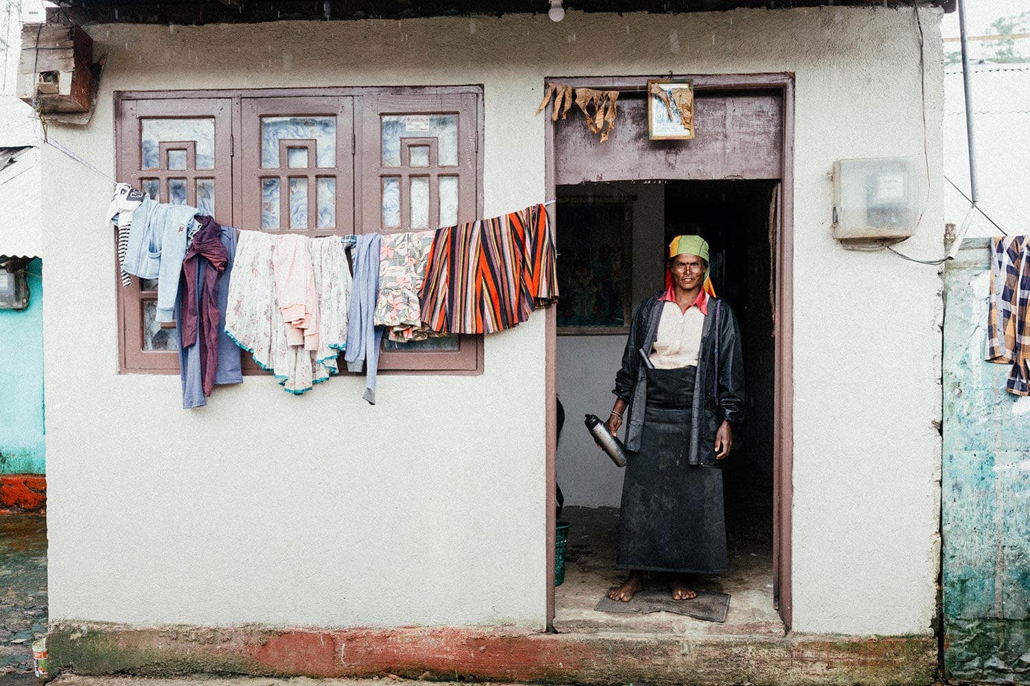
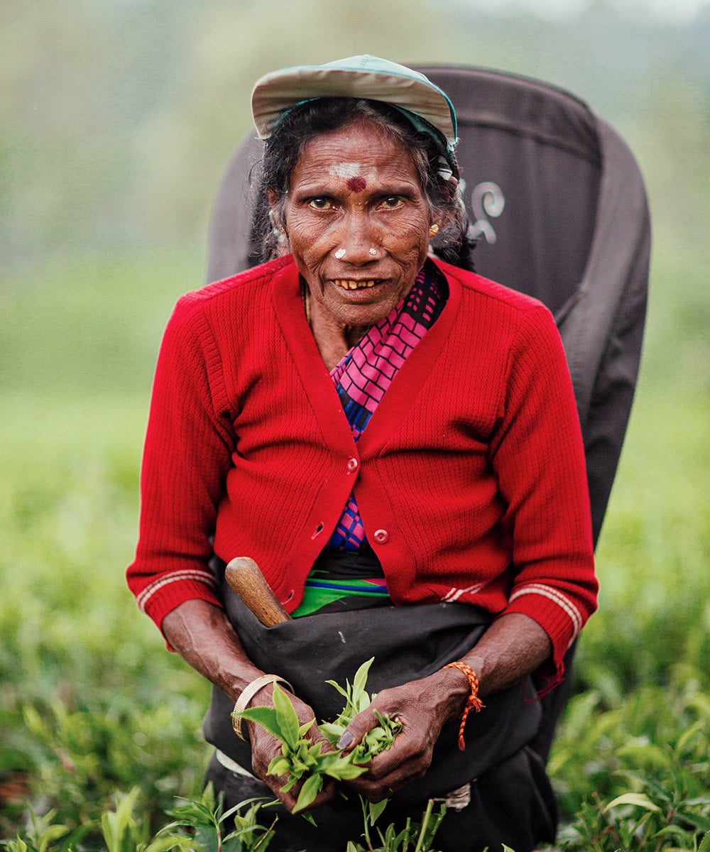
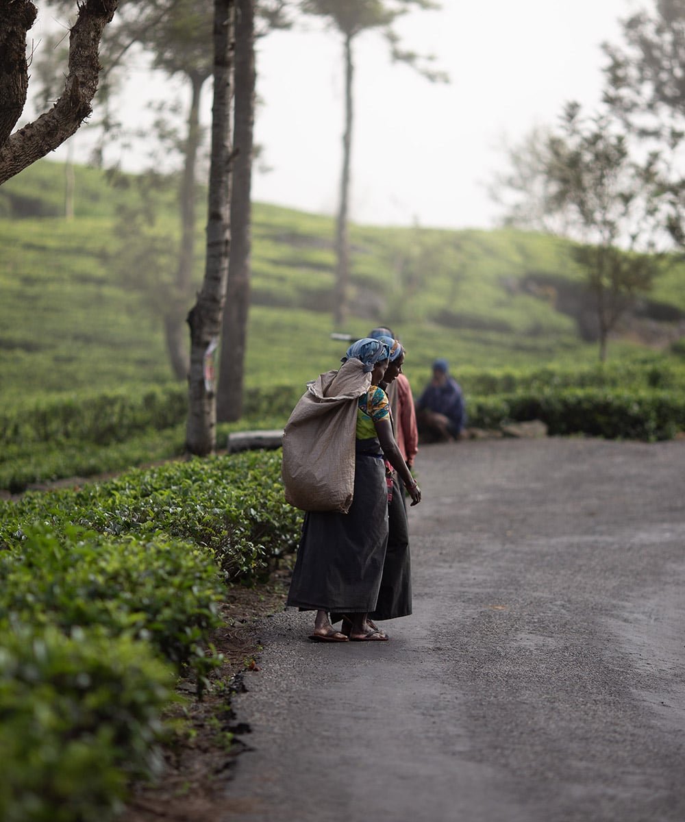
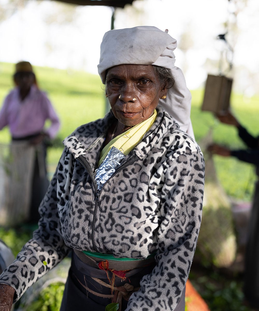
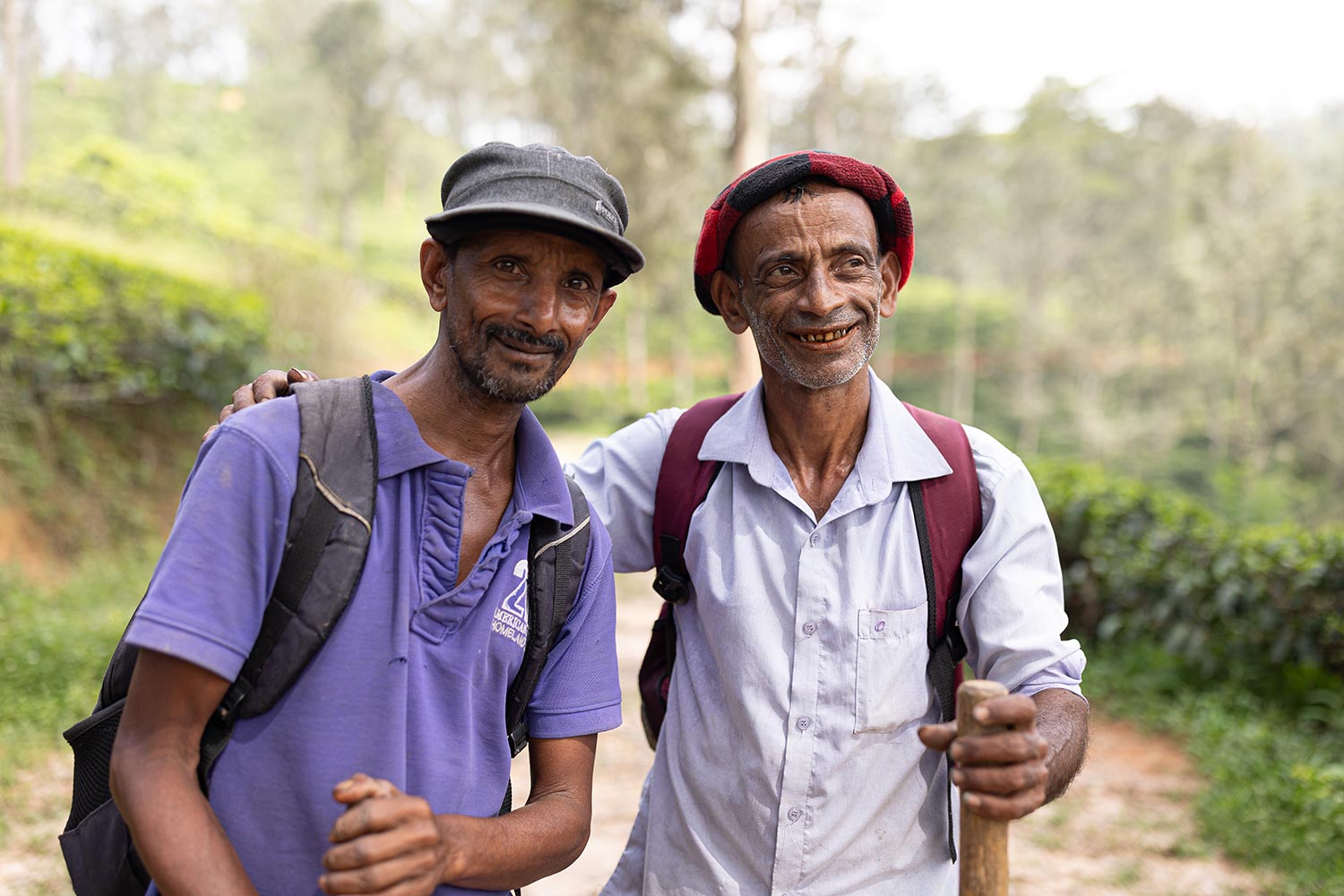
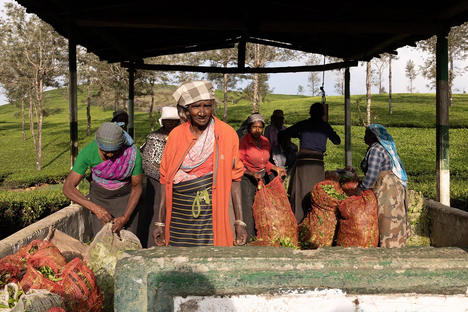
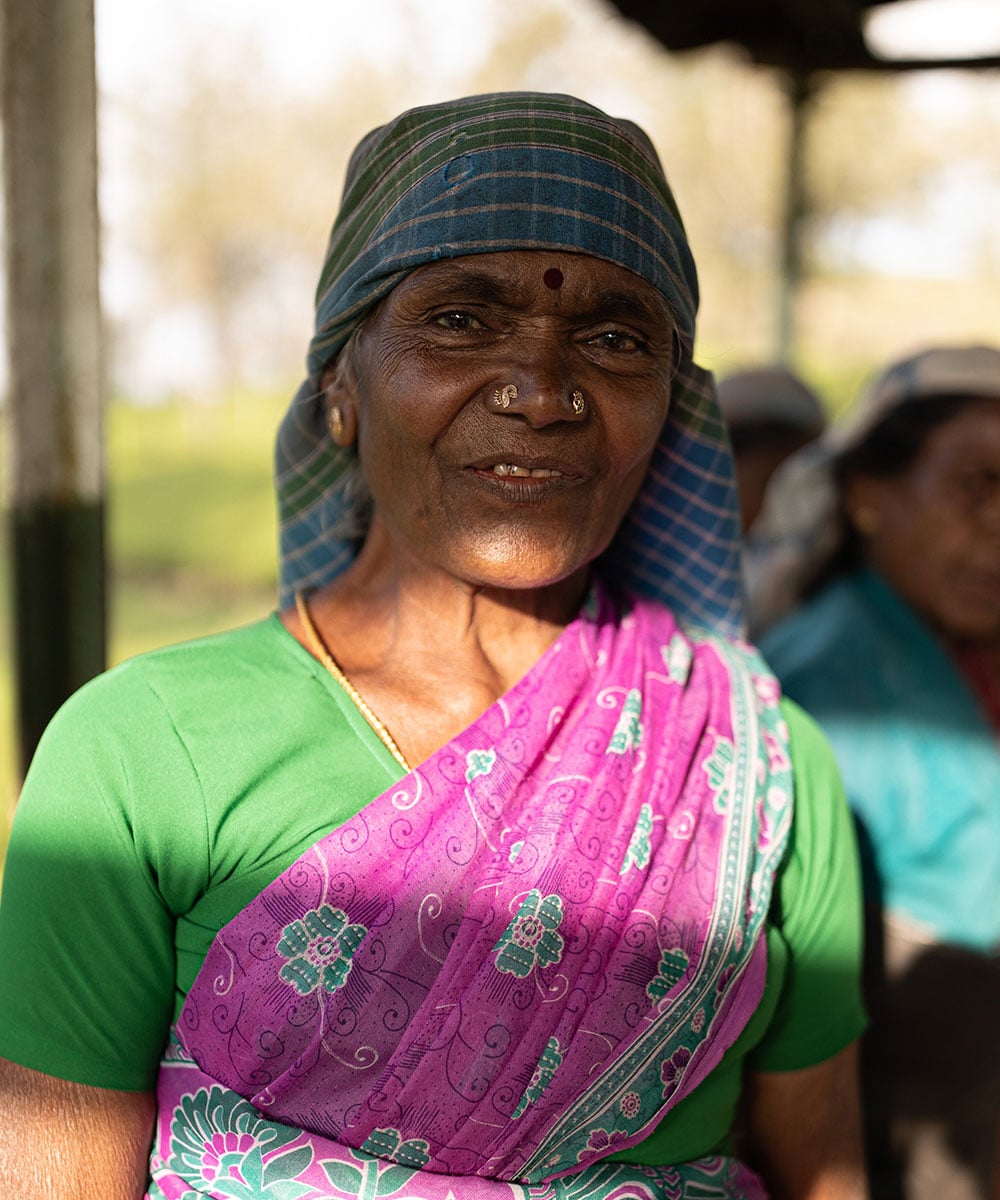
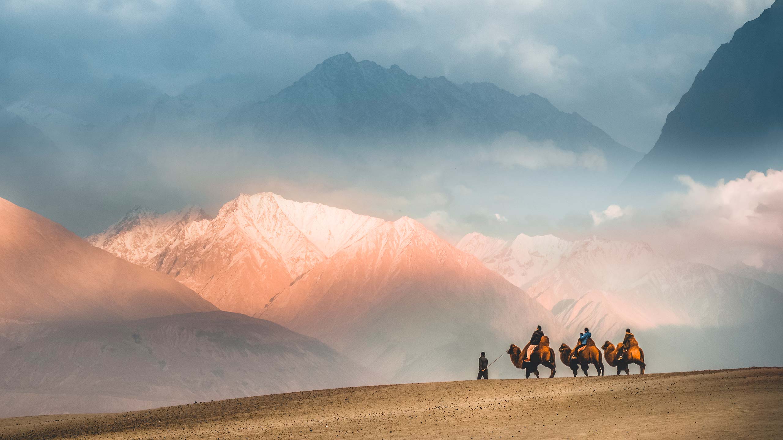
More than just a hiking route, the Pekoe Trail offers a deep connection with the communities whose ancestors helped forge Sri Lanka’s tea legacy. You'll trad the same paths where Scottish pioneers once laid the foundations of the industry, trace ancient routes etched through mountain passes, and encounter hidden villages where sari-clad tea pluckers continue generations-old traditions.
Shortly after its debut, The Pekoe Trail earned global acclaim—named as one of the World's Greatest Places by TIME (2025) and featured in National Geographic’s "Best of the World 2024". Blending spectacular natural beauty with rich cultural heritage, this trail is also a beacon of sustainable tourism, directly benefitting the local communities it winds through.
The Visionary Behind the Trail
The Pekoe Trail was born from the vision of Miguel Cunat, a Spanish explorer who fell under Sri Lanka's spell more than two decades ago. Inspired by his experience walking Spain's legendary Camino de Santiago, Cunat spent over a decade mapping forgotten paths through the island’s mist-shrouded highlands.
"When I moved to Sri Lanka 20 years ago, I dreamed of a trail that would stitch together the central highlands, its tea plantations, villages, forests and people, into one cohesive journey," he explains.
With support from the European Union and USAID, that dream become reality. But what Cunat created is more than just a hiking trail—it's a living bridge between the romance of colonial-era tea culture and the vibrant, contemporary life of Sri Lanka’s hill country communities.
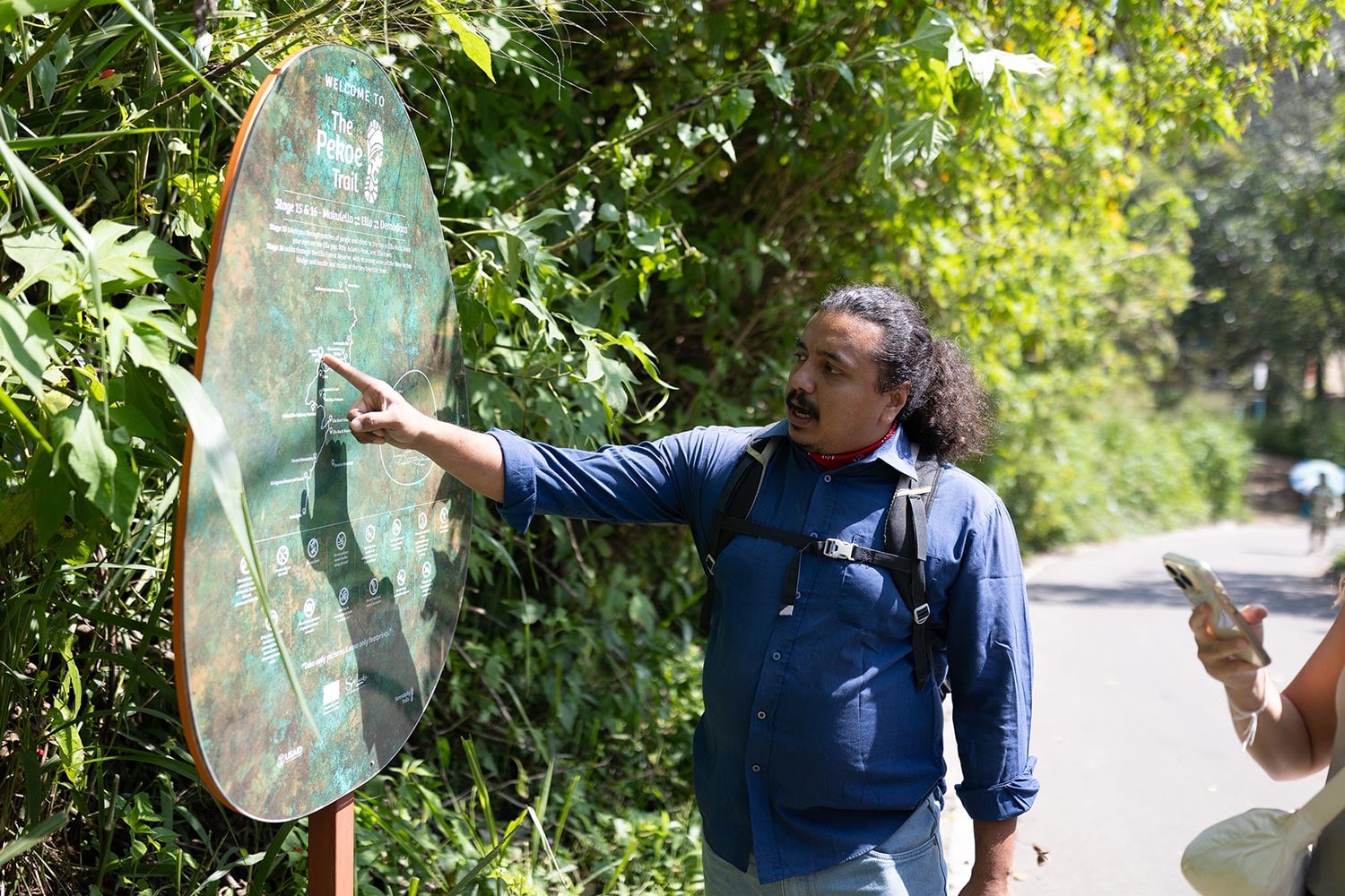
Experience The Pekoe Trail with Red Dot
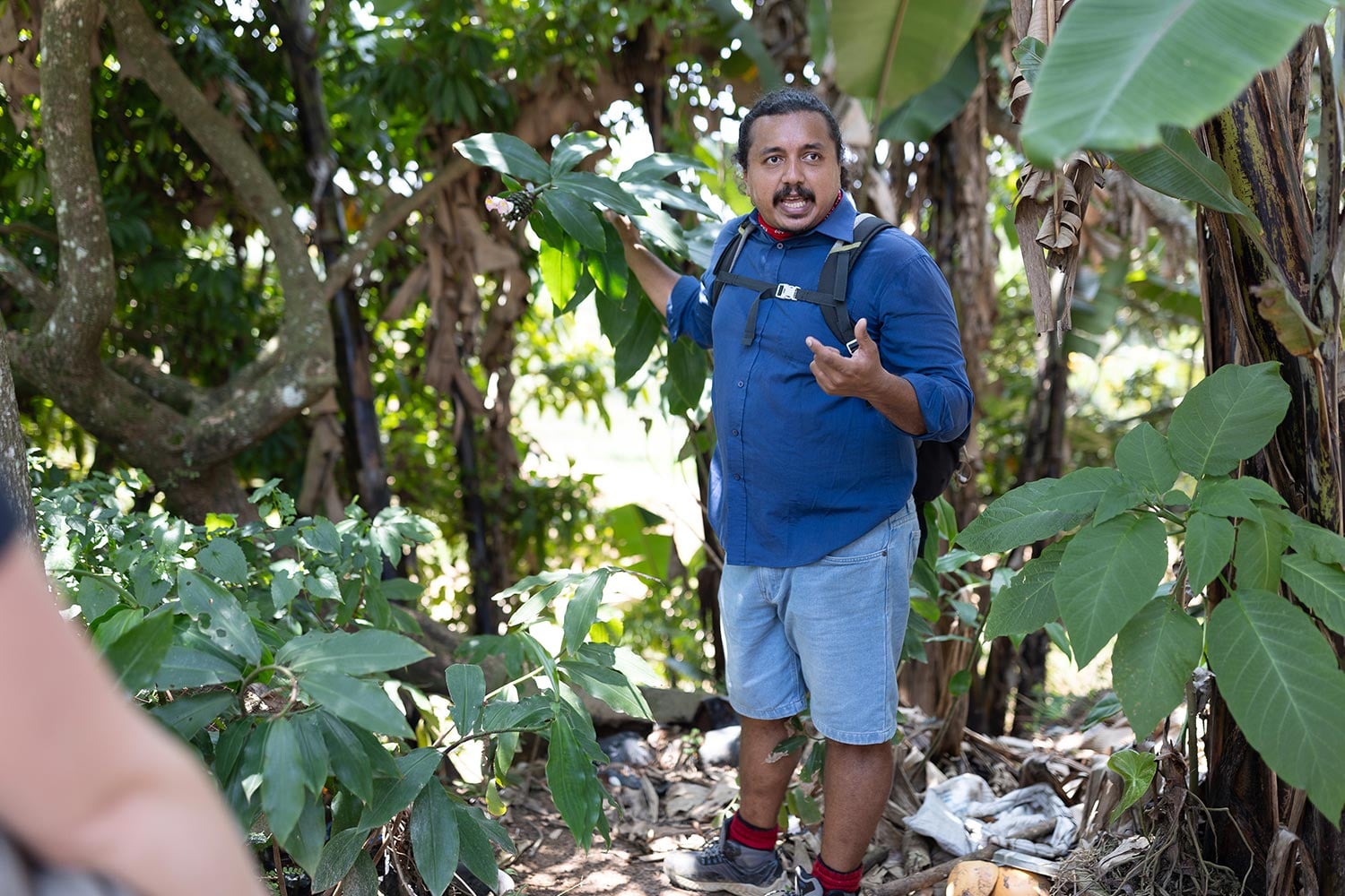
Red Dot offers guided treks along the Pekoe Trail, led by knowledgeable local guides who bring Sri Lanka’s tea country to life. Our long collaboration with Miguel Cunat, the trail’s founder, gives us unique insight into its origins and purpose.
Guides share the history of the tea estates, explain local customs, and introduce the region’s flora and fauna—identifying endemic birds, native plants, and wildlife—while helping travellers connect meaningfully with the communities along the route.
The tea plantations’ social fabric is intricate, shaped by diverse cultural backgrounds and complex histories. For those seeking deeper understanding, we can arrange specialist guides who explore estate life in greater detail, making each trek a more immersive and enlightening experience.
Need a helping hand?
Whatever your passion, we make it happen.
The 22 Stages of the Pekoe Trail
Distance: 12.84 km (7.98 mi) | Duration: 4 hours | Difficulty: Easy
The trail begins at the Ceylon Tea Museum on the Hantana Estate, built on the ruins of the old Hantana Tea Factory. This opening stage takes hikers from the misty Hanthana mountains near Kandy through scenic tea estates.
Distance: 14.70 km (9.13 mi) | Duration: 5 hours | Difficulty: Difficult
This stage passes through Loolkandura Estate, the first plantation in Sri Lanka, started by Scotsman James Taylor. The route follows historical paths and offers glimpses into Sri Lanka's tea heritage.
Distance: 18.11 km (11.25 mi) | Duration: 6 hours | Difficulty: Difficult
This stage begins at the small bridge over the Ma Oya on the Loolecondera Estate and is considered a challenging route great for hiking and walking.
Distance: 15.53 km (9.65 mi) | Duration: 4 hours 30 minutes | Difficulty: Difficult
A moderately challenging 10.8-km trail that takes around 3 hours and 28 minutes to complete, ideal for hiking and walking.
Distance: 14.31 km (8.89 mi) | Duration: 4 hours 30 minutes | Difficulty: Moderate
An 11.7-km point-to-point trail that takes around 3 hours and 46 minutes to complete, moderately challenging and suitable for hiking.
Distance: 14.97 km (9.3 mi) | Duration: 4 hours 30 minutes | Difficulty: Easy | Special trail hours apply
This 14.8-km point-to-point trail near Dikoya is generally considered moderately challenging and takes an average of 4 hours 15 minutes to complete.
Distance: 16.48 km (10.24 mi) | Duration: 5 hours | Difficulty: Moderate | Special trail hours apply
This stage starts in the town of Kotagala with a brightly painted Hindu Kovil serving as an anchor point. The trail follows tea estate tracks through the Drayton Estate and features the colonial-era Chrysler's Farm Tea Factory built in 1870, and Singamalai Lake which supplies drinking water for Hatton and surrounding villages.
Stay: Camellia Hills
Distance: 15.93 km (9.89 mi) | Duration: 4 hours 30 minutes | Difficulty: Moderate | Special trail hours apply
Norwood is the gateway to the Bogawantalawa Valley and serves as a major crossroads for those venturing deep into tea country. This stage climbs towards a ridge that separates the Bogawantalawa and Maskeliya valleys, considered amongst the most beautiful places in the tea country.
Stay: Camellia Hills, Ceylon Tea Trails
Distance: 17.13 km (10.64 mi) | Duration: 5 hours | Difficulty: Hard | Special trail hours apply
This stage takes hikers through challenging terrain in the heart of the tea country.
Distance: 15.88 km (9.86 mi) | Duration: 5 hours | Difficulty: Difficult | Special trail hours apply
This stage is currently under indefinite closure as discussions continue with the Ministry of Wildlife Conservation to enable access to Horton Plains via Dayagama.
Distance: 14.30 km (8.88 mi) | Duration: 4 hours | Difficulty: Moderate | Special trail hours apply
This stage starts at the Farr Inn, the old hunting lodge for high-ranking British colonial officials, now turned into a visitor center run by the Department of Wildlife Conservation.
Distance: 19.68 km (12.22 mi) | Duration: 6 hours | Difficulty: Difficult
The Udaweriya Valley is one of the most remote valleys in the tea country, sometimes called the hidden valley. On clear days, hikers may see the ocean from these amazing viewpoints.
Distance: 14.60 km (9.07 mi) | Duration: 4 hours | Difficulty: Hard
This stage brings hikers into one of the major towns in Sri Lanka's tea country.
Stay: Thotalagala
Distance: 9.36 km (5.81 mi) | Duration: 3 hours | Difficulty: Moderate
This scenic route takes hikers from Haputale to one of the tea country's better-known landmarks, the upper divisions of the Nayabedda Tea Estate where Sir Thomas Lipton would survey his favorite tea estates. The trail passes through a cool and humid forest reserve towards the Thotalagala-Dambatenne Valley.
Stay: Thotalagala
Distance: 9.61 km (5.97 mi) | Duration: 3 hours | Difficulty: Moderate
This stage connects to the popular hill town of Ella, known for its stunning viewpoints and vibrant backpacker scene.
Stay: 98 Acres
Distance: 9.50 km (5.90 mi) | Duration: 3 hours | Difficulty: Easy
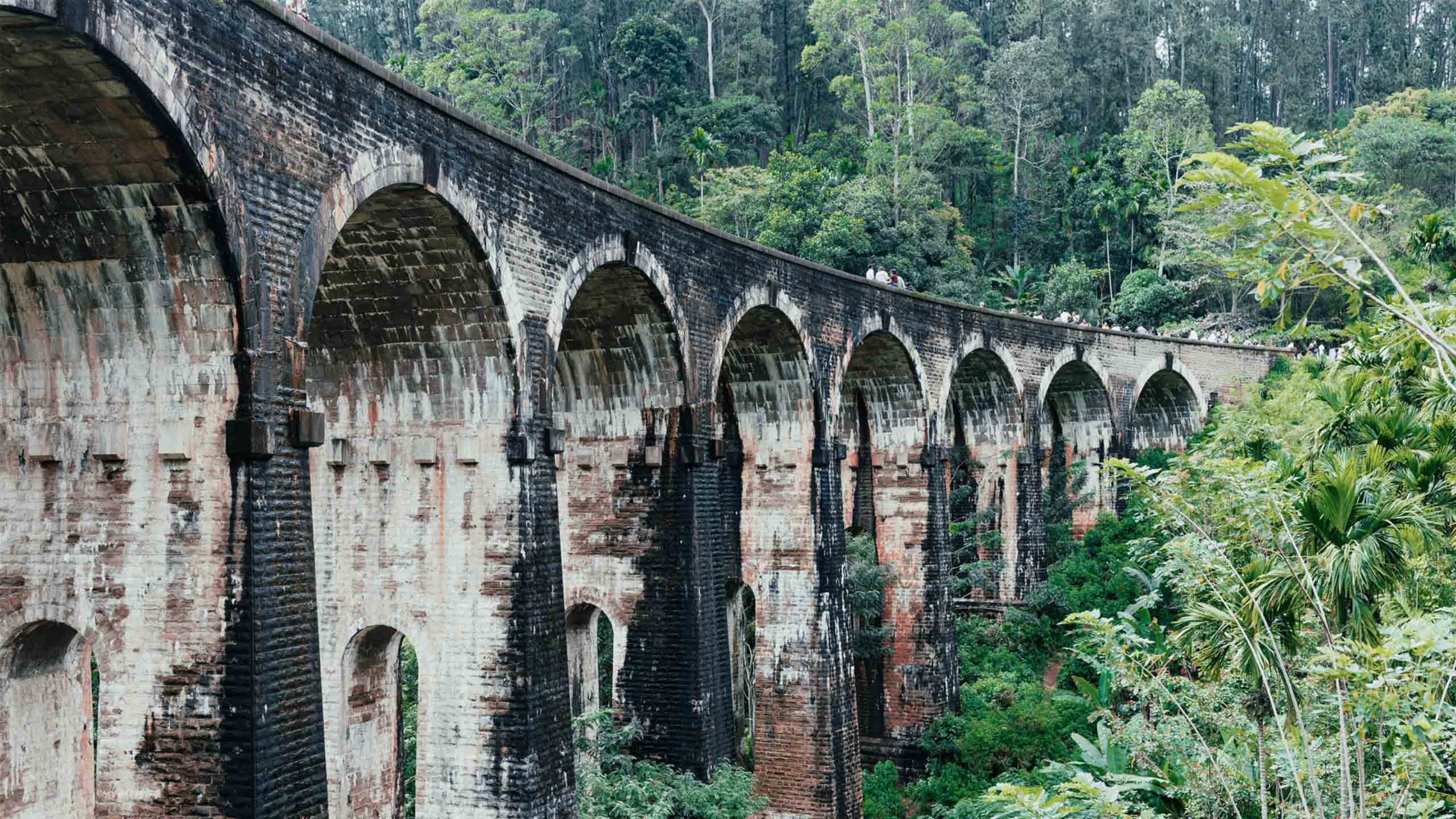
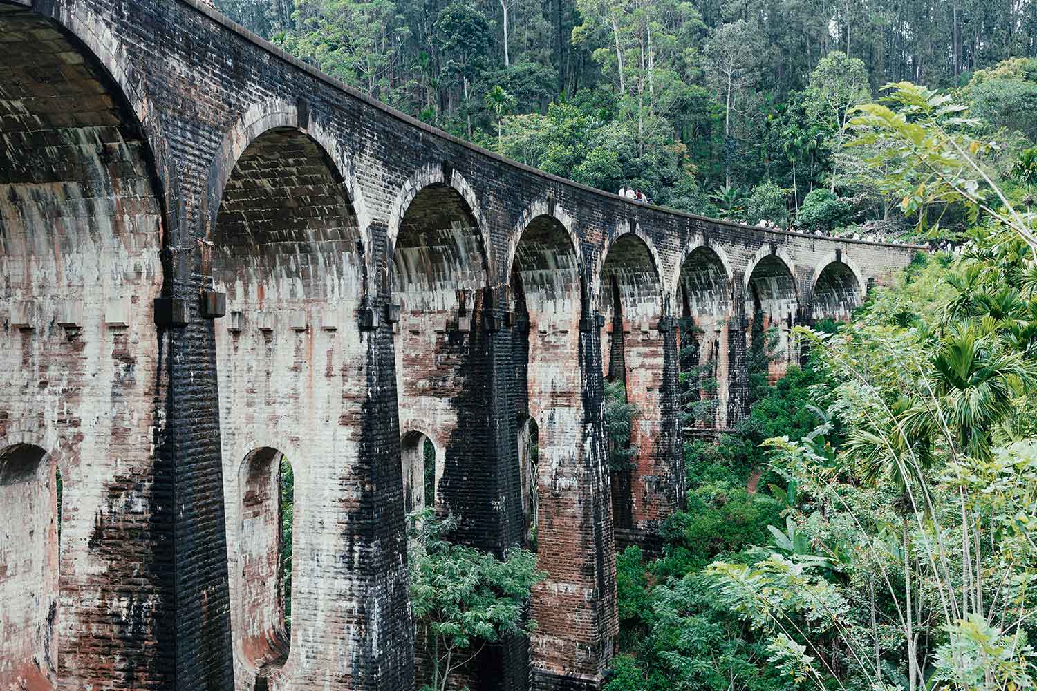
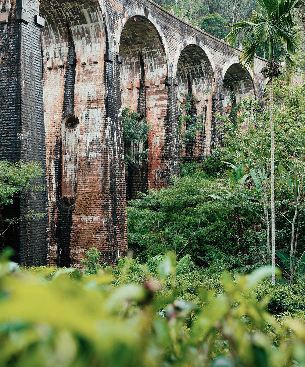
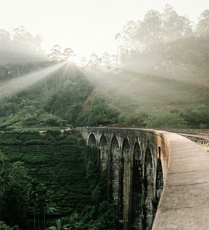
Stage 16 is a beautiful and relatively easy walk between Ella and Demodara that passes through a large tea plantation with good signage and easy navigation. This stage crosses the scenic Nine Arch Bridge, a vast viaduct surrounded by lush greenery.
Stay: Nine Skies, The Pinnacle Ella
Distance: 13.15 km (8.17 mi) | Duration: 4 hours 30 minutes | Difficulty: Moderate
This stage continues through tea plantation landscapes and traditional villages.
Distance: 14.68 km (9.12 mi) | Duration: 6 hours | Difficulty: Hard
A challenging stage that takes hikers through diverse terrain in the central highlands.
Distance: 21 km (13.04 mi) | Duration: 6 hours | Difficulty: Difficult
The longest stage of the trail, offering extensive views across the hill country.
Distance: 13.63 km (8.46 mi) | Duration: 4 hours 30 minutes | Difficulty: Moderate
This stage brings hikers to Hatton, an important railway town in the tea country.
Distance: 16.90 km (10.50 mi) | Duration: 5 hours 30 minutes | Difficulty: Difficult
A challenging stage approaching the final destination of the trail.
Stay: Uga Haloowella
Distance: 11.30 km (7.02 mi) | Duration: 4 hours 30 minutes | Difficulty: Moderate
The final stage begins in Kandapola, a bustling transit town 14 km east of Nuwara Eliya. The trail circles around one of the oldest tea estates in the region and concludes at the iconic Pedro Tea Estate. An optional detour leads to Lover's Leap waterfall, with its name rooted in a poignant local legend.
Stay: Uga Haloowella, Ferncliff Bungalow, Stafford Bungalow
Best Time to Visit: The best time to hike Sri Lanka's highlands is during the dry season (December to April), when there's plenty of sunshine but the air is still cool. Avoid May to August when monsoon rains are at their peak.
Trail Access: The trail has been free to hike, though there are plans to introduce a trail pass costing US$10 per person per stage. Most stages are open from 6am to 6pm, with some stages having shorter hours, especially in wildlife corridors and protected areas.
Difficulty and Flexibility: Each stage averages about 12 km and varies in difficulty based on elevation gain. The stages can be completed individually or as part of a multi-day experience, making it accessible to hikers of different experience levels.
The Pekoe Trail offers an unparalleled opportunity to experience Sri Lanka's tea heritage, natural beauty, and local communities while supporting sustainable tourism development in the region.
Our approach
Why travel with Red Dot?


Choose your adventure
Speak to one of our team to get started. After all, your travel journal won’t write itself.
